SimPEG.utils.plot_1d_layer_model#
- SimPEG.utils.plot_1d_layer_model(thicknesses, values, z0=0, scale='log', ax=None, plot_elevation=False, show_layers=False, vlim=None, **kwargs)[source]#
Plot the vertical profile for a 1D layered Earth model.
- Parameters
- thicknesses
listornumpy.ndarrayoffloat A
listornumpy.ndarraycontaining the layer thicknesses from the top layer down- values
listornumpy.ndarrayoffloat A
listornumpy.ndarraycontaining the physical property values from the top layer down- z0
float Elevation of the surface
- scale: {‘linear’, ‘log’}
Plot physical property values on a linear or log10 scale.
- ax: matplotlib.axes.Axes, optional
An axis object for the plot
- plot_elevationbool
If
False, the yaxis will be the depth. IfTrue, the yaxis is the elevation.- show_layersbool
Plot horizontal lines to denote layers.
- vlim
tuple,optional The limits for the x-axis.
- thicknesses
- Returns
matplotlib.axes.AxesThe axis object that holds the plot
Galleries and Tutorials using SimPEG.utils.plot_1d_layer_model#
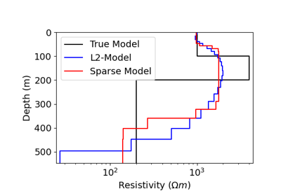
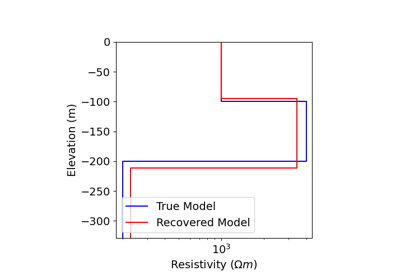
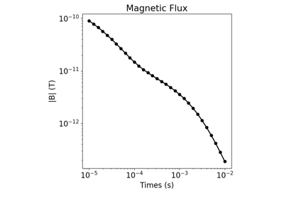
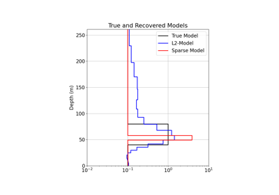
1D Inversion of Time-Domain Data for a Single Sounding
1D Inversion of Time-Domain Data for a Single Sounding